Trekking
Paths beginning at the beach and going along cliffs, offering endless views of the Mediterranean. Trails with history leading to 16th century anti-corsair defence towers or to the best preserved funerary tower on the peninsula.
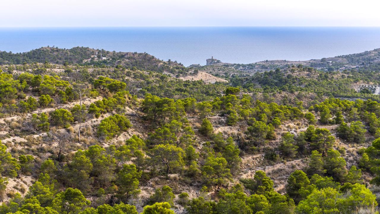
Routes that start on the coast and continue in search of the mountains. Flora, fauna and typical Mediterranean vegetation mark the way. Walking among pine trees, following the pilgrim's yellow arrow, enjoying fantastic sunrises and sunsets, crossing the ancient border between the kingdoms of Aragon and Castile.....
Don't forget that "Hiking and happiness go hand in hand" according to Diane Spirce, so in La Vila Joiosa you have multiple possibilities to be really happy.
See Rute of Saint James Way at Vilamuseu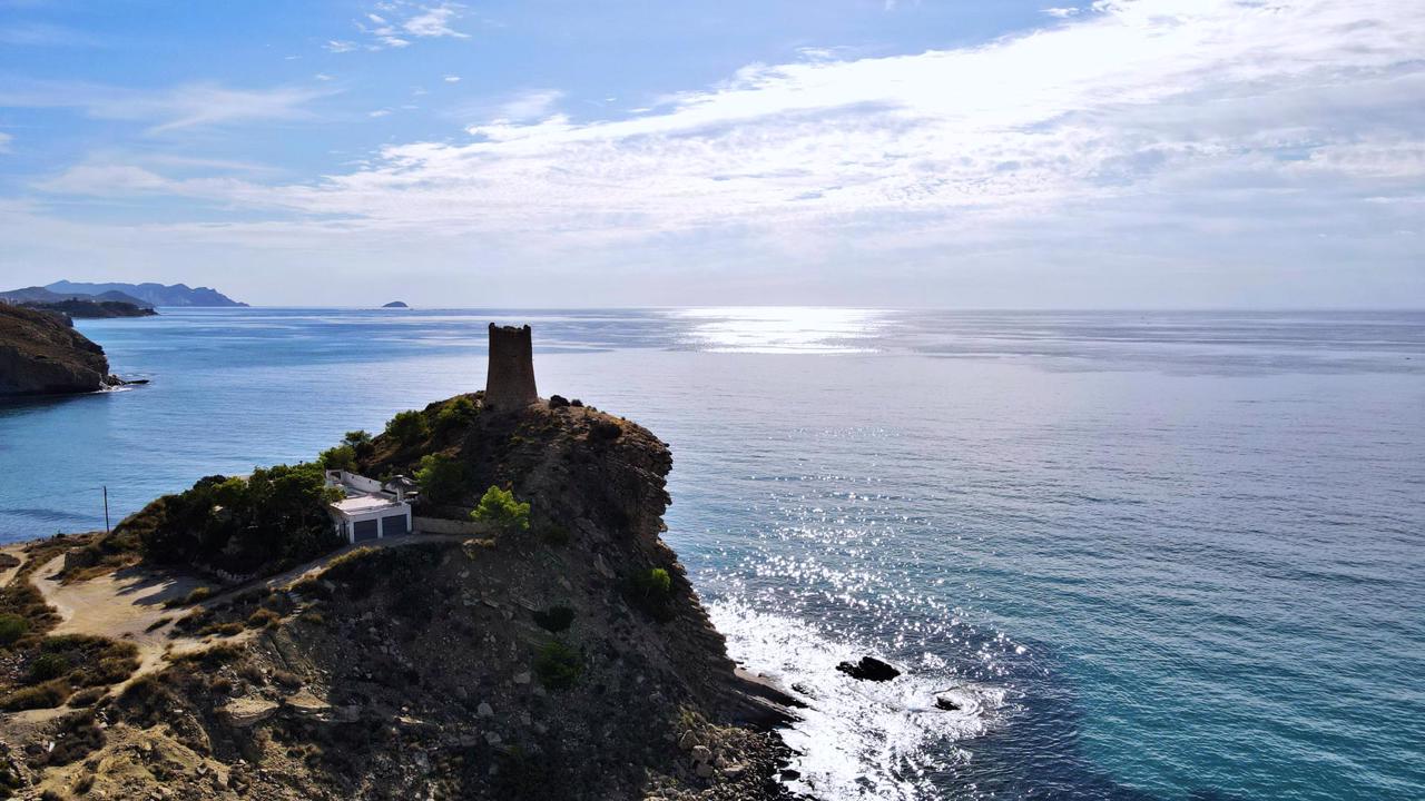
The Colada de la Costa or Sender de la Costa (The Coast path ) links the Torres Beach with the cove of La Vila Joiosa and gives access to the Torre de l'Aguiló (a 16th century anti-corsair watchtower) from where we will have a spectacular view of both the skyline and the bay of Benidorm and Alicante.
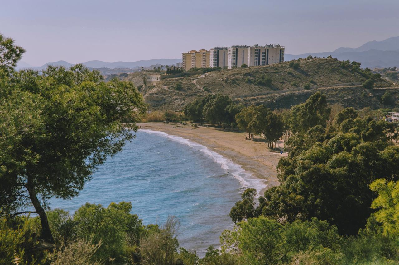
This circular route, approximately 8 kilometres long, takes us along a perfectly signposted path that runs along a part of the former cattle track that used to cross the entire coast of Vila. A walk suitable for the whole family, which allows us to lose ourselves in the infinite blue of the Mediterranean, as we walk parallel to the coast over cliffs falling into the sea. Along the way we will find some coves difficult to access except for the 'Racó del Conill', a very popular naturist beach, with crystal clear waters, pebbles and sand, where snorkelling enthusiasts will enjoy the beautiful seabed.
In addition, the Colada de la Costa allows us to enjoy stretches of coastline without buildings, with a great natural wealth. As this is a coastal route, we must pay attention to the sea to enjoy its fauna, especially seabirds, such as the sea raven, and even dolphins. Regarding vegetation, we also find some peculiarities typical of the saline effect, due to its proximity to the sea, and the winds of the area. For example, the pine trees grow in a flag shape to protect themselves from the salty winds from the sea.
Before or after the route, on Torres beach, a pebble beach with a huge grove of trees, we should visit the 'Torre de Sant Josep', the best preserved funerary monument from the Roman period in Spain.
See route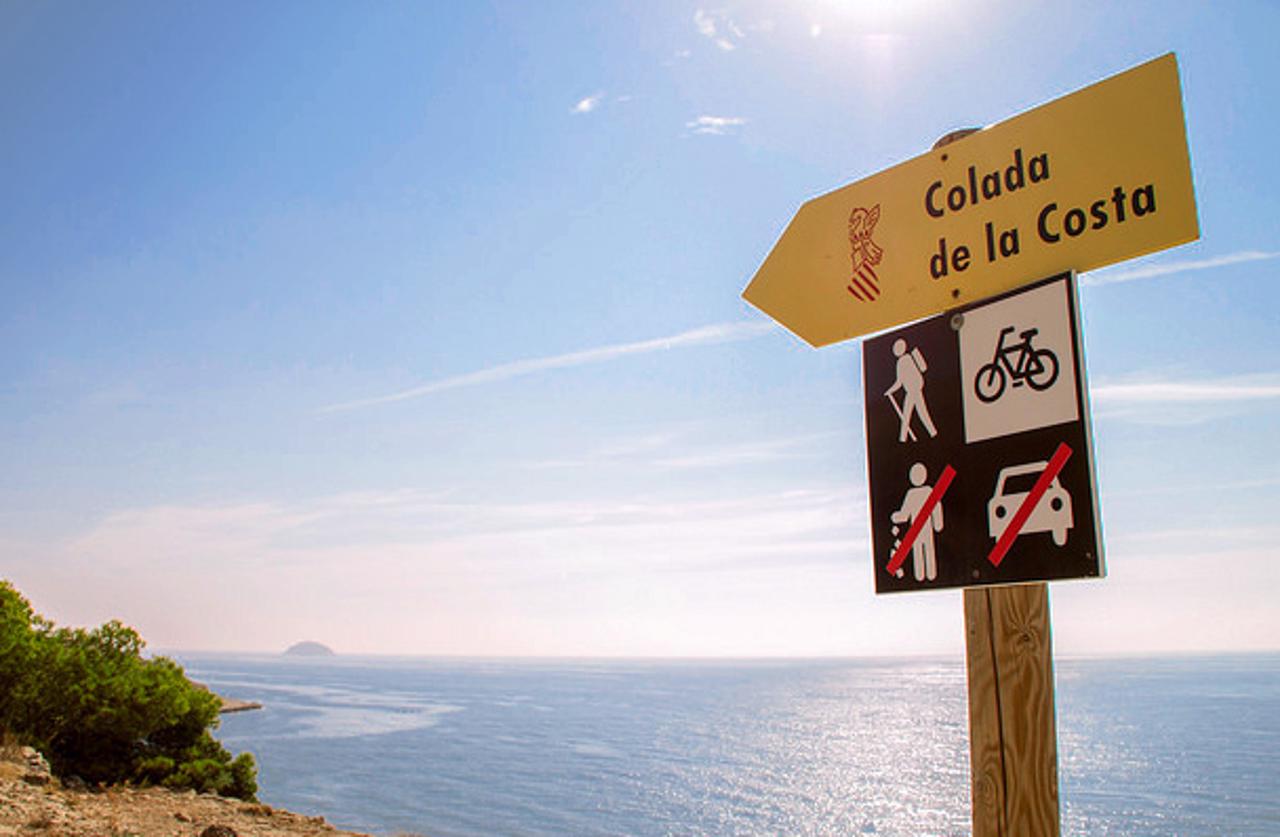
This route will take us to the heart of the mountains of La Vila Joiosa. It runs through the highest mountains of La Vila Joiosa passing by the emblematic crag of Cantal, whose name derives from the Latin cant, meaning thick stone, and next to the old border between the kingdoms of Aragon and Castile.
It is a long but easy route as it mainly runs along forest tracks. A path of great environmental richness that allows us to enjoy different birds and the Mediterranean vegetation, such as pines and honeysuckles, a climbing plant that in shady areas climbs among the existing flora creating a tangle of vegetation. On this route you can enjoy one of the few remaining pine forests near the coast.
From El Cantal you can organise different excursions. For example, you can go down the 'l'aigüeta' gully to the Xarco beach, or follow a path along the crest of the 'Mola' mountain, with an impressive view of the sea and the inland area. From there you can go down to the Amadorio reservoir, although this stretch is not signposted.
And remember, always follow the marked paths and reduce our impact on nature to a minimum, so the animals do not feel their habitat altered.
See routeThe Xarco Tower is an anti-corsair watchtower from the 16th century, located on a ledge to the sea at 31 metres height, on the south side of the beach of the same name. The Xarco is a natural beach of pebbles and sand, quiet and suitable for dogs.
From the Tourist Office to this setting you will pass many beaches in La Vila Joiosa such as El Paradís, Bol Nou, Asparralló and La Caleta. In addition, the path that links La Caleta with the Xarco is a beautiful walk, barely 2 kilometres long, bordering the Mediterranean over the cliffs that cut into the sea.

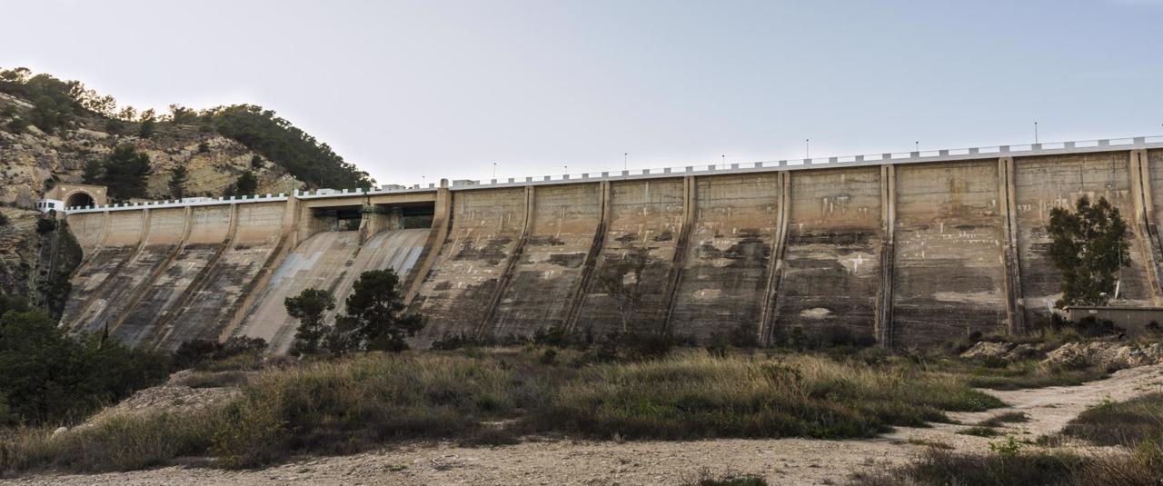
The route to the reservoir is a walk that will allow us to visit part of the orchard of La Vila Joiosa. We will discover the Hermitage of San Antonio, one of the oldest quarters of La Vila Joiosa where the patron saint's fiestas of San Miguel are held in September, although the most popular and most widely attended are the Moors and Christians in honour of Santa Marta in July. We will pass by the 'Cruz de Piedra' . It is a 'crucero' (Stone Calvary cross) dated back to the 16th century. This type of crosses were used to Christianise the crossroads that once were sacred places for the Romans.
During the route we will also find 'legendary places' such as the 'Roca Encantà' which is a strange rock next to a path about which several stories are told. The most typical is the one that says that on the night of San Juan the rock opens up and a witch with coloured ribbons comes out of the rock..... Be careful not to take the black ribbon, because it will not bring you anything good.
In this area there is also the 'Olivera grossa'. It is a monumental tree and one of the oldest in Spain, more than 1,400 years old. Its convoluted trunk makes it a special tree, as well as its dimensions: 8.9 metres trunk, 11.5 metres crown and 7 and a half metres high.
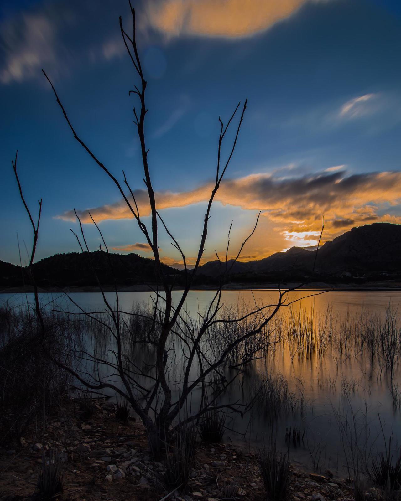
Olive, orange and lemon groves mark the path until we reach the dam of the Amadorio reservoir. From there we have a perfect panoramic view of the river course all the way to the sea. If we cross the dam we can follow a path that borders the entire reservoir and gives us the opportunity to enjoy different species of birds and varied vegetation, fauna and flora typical of wetlands.